

Top 7 Benefits Of Aerial Photography & Construction Drone Services
Aerial photography and construction drone services have revolutionized the way businesses operate in a variety of industries. From construction and real estate to agriculture and surveying, the benefits of using drones for aerial photography and data collection are undeniable. In this article, we will explore the top 7 benefits of aerial photography and construction drone services.
Accurate Data Collection
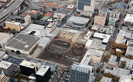
Aerial photography and construction drone services provide accurate data collection that can be used for a variety of purposes. Drones equipped with high-resolution cameras and sensors can capture images and data from various angles and elevations, allowing for a comprehensive view of a site or project. This data can then be used to create accurate 3D models, maps, and survey reports, which is not possible with traditional photography.
Therefore, aerial photography and construction drone services are quickly becoming the preferred choice for collecting accurate data. By taking photographs and videos of structures, landscapes, and other areas from a distance, these services can provide precise information that would be difficult to collect otherwise.
With the ability to access hard-to-reach places, drones can survey an area in a fraction of the time it would take a person on foot or in a vehicle. The accuracy of this data is invaluable for those in the construction industry as well as other businesses that require detailed information about their environment. If you want to do an aerial photoshoot of the construction site, then you should hire the best drone services.
Improved Safety
Aerial photography and construction drone services improve safety on job sites by reducing the need for workers to perform tasks at heights or in hazardous conditions. Drones can be used to inspect structures, buildings, and other areas that are difficult or dangerous to access. This reduces the risk of accidents and injuries and improves overall safety on the job site.
By using drones to capture aerial images, companies can monitor progress safely without putting their workers at risk. This not only improves safety but also helps contractors gain a better understanding of the job site before any work begins. In addition, drone services can provide detailed images of hazardous areas or structures that would otherwise be difficult to access with traditional methods.
Faster Project Completion
Aerial photography and construction drone services can help speed up project completion by providing real-time data and insights. Drones can be used to monitor project progress, identify issues and delays, and make adjustments as needed. This improves project efficiency and reduces overall project completion time.
Aerial photography and construction drone services offer a unique and efficient way to monitor site progress, identify potential risks, document project milestones, and ensure safety compliance. These services provide an unprecedented level of detail that is impossible for traditional ground-level surveys to achieve. With aerial photography and construction drone services, project managers can quickly observe the progress of their projects from a bird’s eye view, allowing them to make adjustments or changes in real time so that projects can be completed faster without compromising on quality.
Cost-Effective
Aerial photography and construction drone services are cost-effective options compared to traditional surveying and data collection methods. Drones can cover large areas quickly and efficiently, reducing the need for expensive equipment and manpower. This saves time and money and can improve the overall profitability of a project.
Aerial photography and construction drone services are revolutionizing the way businesses view projects. By utilizing these services, companies can save time and money by capturing aerial images of sites more quickly and accurately than ever before. These technologies enable businesses to get a clearer picture of their projects, allowing them to make decisions faster, reduce costs, and increase safety precautions.
Improved Communication
Aerial photography and construction drone services can improve communication between team members and stakeholders. Real-time data and insights can be shared with project managers, contractors, and other stakeholders, allowing for better decision-making and coordination.
Aerial photography and construction drone services are revolutionizing how the construction industry communicates. With the help of these advanced tools, builders can get a bird’s-eye view of their projects, allowing them to track progress, track safety issues and see potential problems before they become costly mistakes. These services provide an easy way to share project updates with clients and stakeholders, ensuring that everyone is always up to date on what’s happening.
Improved Quality Control
Aerial photography and construction drone services can be used for quality control by monitoring project progress and identifying issues in real time. This allows for quick and effective problem-solving, reducing the likelihood of errors or delays. With high-resolution cameras, these drones can capture detailed images of construction sites, allowing for precise measurements and accurate analysis. Additionally, they provide a safe way to inspect hard-to-reach areas with minimal disruption to the site or workers. This technology allows for real-time monitoring, ensuring that quality control standards are met efficiently and cost-effectively.
Environmental Monitoring
Aerial photography and construction drone services can be used for environmental monitoring and conservation efforts. Drones equipped with sensors can capture data on air and water quality, soil erosion, and other environmental factors. This information can be used to inform conservation efforts and make better-informed decisions about environmental impact.
Aerial photography and construction drone services are revolutionizing the way we monitor our environment. With their high-resolution cameras and accurate data, they can provide detailed images of any given area that can be used to detect changes in land use, vegetation health, and soil erosion. They have become a valuable tool for environmental monitoring and can help scientists better understand our ecosystems.
Final Words
In conclusion, aerial photography and construction drone services offer a range of benefits to businesses and organizations across various industries. From accurate data collection and improved safety to cost-effectiveness and environmental monitoring, the use of drones for aerial photography and data collection is a valuable tool for modern businesses. As technology continues to advance, the possibilities for aerial photography and construction drone services will only continue to grow.